
User:Ɱ/Portal:Columbus, Ohio
Portal maintenance status: (October 2021)
|
Introduction

Columbus (/kəˈlʌmbəs/, kə-LUM-bəs) is the capital and most populous city of the U.S. state of Ohio. With a 2020 census population of 905,748, it is the 14th-most populous city in the U.S., the second-most populous city in the Midwest after Chicago, and the third-most populous U.S. state capital after Phoenix, Arizona and Austin, Texas. Columbus is the seat of government of Franklin County; it also extends into Delaware and Fairfield counties. It is the core city of the Columbus metropolitan area, which encompasses ten counties in central Ohio. It had a population of 2,138,926 in 2020, making it the largest metropolitan area entirely in Ohio and 32nd-largest metro area in the U.S.
Columbus originated as numerous Native American settlements on the banks of the Scioto River. Franklinton, now a city neighborhood, was the first European settlement, laid out in 1797. The city was founded in 1812 at the confluence of the Scioto and Olentangy rivers, and laid out to become the state capital. The city was named for Italian explorer Christopher Columbus. The city assumed the function of state capital in 1816 and county seat in 1824. Amid steady years of growth and industrialization, the city has experienced numerous floods and recessions. Beginning in the 1950s, Columbus began to experience significant growth; it became the largest city in Ohio in land and population by the early 1990s. Growth has continued in the 21st century, with redevelopment occurring in numerous city neighborhoods, including Downtown. (Full article...)
Selected general articles
-


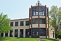
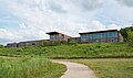
Knowlton Hall at the Ohio State University, by Mack Scogin Merrill Elam
The architecture of Columbus, Ohio is represented by numerous notable architects' works, individually notable buildings, and a wide range of styles. Yost & Packard, the most prolific architects for much of the city's history, gave the city much of its eclectic and playful designs at a time when architecture tended to be busy and vibrant. (Full article...) -

The Central Ohio Transit Authority (COTA /ˈkoʊtə/) is a public transit agency serving the Columbus metropolitan area, headquartered in Columbus, Ohio. It operates fixed-route buses, bus rapid transit, microtransit, and paratransit services.
COTA's headquarters are located in the William J. Lhota Building in downtown Columbus. The agency is managed by President and CEO Joanna Pinkerton along with a 13-member board of trustees. COTA is funded by a permanent 0.25% sales tax as well as another 10-year 0.25% sales tax.
The agency was founded in 1971, replacing the private Columbus Transit Company. Mass transit service in the city dates to 1863, progressively with horsecars, streetcars, and buses. The Central Ohio Transit Authority began operating in 1974 and has made gradual improvements to its fleet and network. Its first bus network redesign took place in 2017. (Full article...) -

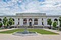
Union Station
This is a list of demolished buildings and structures in Columbus, Ohio. Over time, countless notable buildings have been built in the city of Columbus. Some of them still stand today and can be viewed, however, many local landmarks have since been demolished. The reason for the demolition was often that the condition of the building was no longer adequate, but in some cases, its style was already ostentatious and outdated. Another aspect taken into consideration is that because the cost of renovating a building is very high, demolition is sometimes seen as preferable over renovation. However, today's opinion may not be in line with the views prevalent at the time of its demolition, and many consider it detrimental to demolish buildings that were often built with high artistic demands at the time.
In the early 20th century, Columbus was a dense city dependent on streetcars and downtown retail, with unbroken rooflines. Beginning in the mid-20th century, the city expanded substantially, and the rise of automobiles in popularity created a suburbanized city. Urban renewal became popular, and residents believed that old-looking buildings were causing a loss of business downtown, and so many buildings were demolished and replaced with parking lots. Beginning around 1999, demolitions began to be more discouraged, and city planners began to accept new urbanism and residential development in Downtown Columbus.
There may not be an accurate record of all demolished buildings, so this list is also presumably fragmentary. (Full article...) -

Columbus Museum of Art at The Pizzuti is a museum for contemporary art in Columbus, Ohio, United States. It has been part of the Columbus Museum of Art since September 2018. The three-story gallery is located in the Short North and Victorian Village neighborhoods, on the eastern edge of Goodale Park. Its exhibits rotate, featuring artists from around the world.
The museum was originally owned by the Pizzuti family, which made its wealth from the real estate firm the Pizzuti Companies. The family began collecting art in 1977, after a trip to Paris. The Pizzuti Collection opened in 2013, and had shown 16 temporary exhibits before its 2018 donation to the Columbus Museum of Art. (Full article...) -
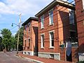
Schumacher Place is a neighborhood in Columbus, Ohio. It is bordered on the north by East Livingston Avenue, the east by Parsons Avenue, the south by East Whittier Street, and the west by Lathrop Street, Brust Street, South Grant Avenue, and Jaeger Street.
The neighborhood borders German Village, an upscale neighborhood to the west. Schumacher Place is similar, with century-old brick houses and brick streets. The neighborhood is however more affordable and has fewer construction and renovation restrictions. The neighborhood is also known for its car museum, the Wagner-Hagans Auto Museum. The museum, a small privately owned organization, offers free admission by appointment. It holds the collections of Steve Wagner (primarily unusual cars) and Mark Hagans (primarily cars of the 1930s).
Schumacher Place is named for a family that operated a dairy company there in the 1800s, in the southeast corner of the neighborhood. (Full article...) -
The Ohio Statehouse is the state capitol building and seat of government for the U.S. state of Ohio. The Greek Revival building is located on Capitol Square in Downtown Columbus. The capitol houses the Ohio General Assembly, consisting of the House of Representatives and the Senate. It also contains the ceremonial offices of the governor, lieutenant governor, state treasurer, and state auditor. Built between 1839 and 1861, it is one of the oldest working statehouses in the United States. The statehouse grounds include two other buildings, the Judiciary Annex or Senate Building, and the Atrium; the three are collectively referred to as the Ohio Statehouse into the present day.
The statehouse's prominent architecture has earned it several landmark designations, including as a National Historic Landmark. The building sees about 500,000 visitors per year. (Full article...) -

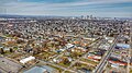
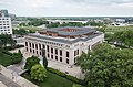
The Franklin County Government Center
The Franklin County Government Center is a government complex of Franklin County, Ohio in the city of Columbus. The government center has included several iterations of the Franklin County Courthouse, including a building completed in 1840 and another completed in 1887. Current courthouse functions are spread out between buildings in the complex. (Full article...) -
Brice is a village in Franklin County, Ohio, United States, on the southeast side of the Columbus metropolitan area. The population was 93 at the 2020 census.
The majority of the village's revenues in 2019 and 2020 were in fines collected with traffic enforcement cameras. Ohio Auditor of State Keith Faber characterized the village as a "speed trap" with "no other reason for it to exist." The speed camera program was suspended in 2021. (Full article...) -

The Central Ohio Fire Museum is a firefighting museum in Downtown Columbus, Ohio, housed in the former Engine House No. 16 of the Columbus Fire Department, built in 1908. It was listed on the Columbus Register of Historic Properties in 1983 and the National Register of Historic Places in 1995.
Details of the building's plans were released in September 1908, drawn by department architect A. C. Burley. The building was renamed Station No. 1 when the old Engine House No. 1 at Front and Elm streets closed. The fire station was one of several built to similar design, along with Engine House No. 14 and Engine House No. 15.
The building was completed in 1908, built as the last in the city to accommodate horse-drawn engines (the transition to motorized equipment began one year later). It was remodeled several times for larger equipment, and was closed in 1982 when the new Station No. 1 was built two blocks away. The city began leasing the station to the Central Ohio Fire Museum, which facilitated a restoration of the building's exterior in 1990. The facade's third story and decorative parapet were rebuilt, along with the top of its hose tower. New doors were added based on the original design as well. (Full article...) -
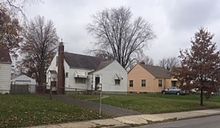
Typical homes in Briggsdale
Briggsdale is a neighborhood of Franklin County in the city of Columbus, Ohio. The neighborhood is on the west/southwest side of the city within the Hilltop area. The area was first settled and founded by the family of Joseph M. Briggs, after whom the neighborhood was named. Joseph Briggs was an active figure in the early years of the township and county operations. The Briggsdale Methodist church was founded with his help, and it now exists as the New Horizons Methodist Church. The present-day Briggsdale neighborhood is located near the historical Green Lawn Cemetery to the north as well as Briggs High School to the west. (Full article...) -
-
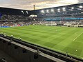
Lower.com Field is a soccer-specific stadium in Columbus, Ohio, United States. It serves primarily as the home stadium of the Columbus Crew of Major League Soccer, replacing the club's previous home, Historic Crew Stadium. The new stadium cost $314 million and is located at the center of the mixed-use Astor Park development adjacent to the Arena District and downtown. It seats 20,371 spectators and includes 30 suites and 1,900 club seats. (Full article...) -

Huntington Park is a baseball stadium located in Columbus, Ohio, United States. It primarily serves as the home of the Columbus Clippers of the International League, the Triple-A minor league affiliate of the Cleveland Guardians since 2009.
Groundbreaking for the ballpark took place on August 2, 2007, with construction being completed in April 2009. Designed by 360 Architecture and developed by Nationwide Realty Investors, the 10,100-seat stadium is part of a $70 million project. The stadium is at the corner of Neil Avenue and Nationwide Boulevard in the Arena District of Columbus and replaced the Clippers' former home, Cooper Stadium.
In February 2006, the naming rights for the park were purchased by Huntington Bancshares Inc. for $12 million over 23 years. On April 18, 2009, the park opened to the public, with the Columbus Clippers playing the Toledo Mud Hens in the stadium's first game. (Full article...) -
Racism is a prevailing issue in the city of Columbus, Ohio, United States. Minority groups may face some societal, health, and legal challenges not experienced by non-minority residents.
Racism was recognized as a public health crisis in Columbus and its surrounding county, Franklin County, in 2020. (Full article...) -

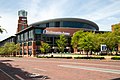
Nationwide Arena is a multi-purpose arena in the Arena District of Columbus, Ohio. Since completion in 2000, the arena has served as the home of the Columbus Blue Jackets of the National Hockey League (NHL). It is one of two facilities in Columbus, along with Greater Columbus Convention Center, that hosts events during the annual Arnold Classic, a sports and fitness event hosted by actor, bodybuilder, and former Governor of California Arnold Schwarzenegger. (Full article...) -
The Brewery District, traditionally known as the Old German Brewing District, is a neighborhood located in Columbus, Ohio. Located just south of the central business district and west of German Village, it is bounded by Interstate 70 on the north, South Pearl Street on the east, Greenlawn Avenue on the south, and the Scioto River on the west. (Full article...) -
The following is a bibliography of Columbus, Ohio. It includes selected publications specifically about the city of Columbus, Franklin County, and the Columbus metropolitan area. (Full article...)
-

Columbus College of Art & Design (CCAD) is a private art school in Columbus, Ohio. It was founded in 1879 as the Columbus Art School and is one of the oldest private art and design colleges in the United States. Located in downtown Columbus, CCAD's campus consists of 14 buildings (including 2 residence halls) on 9 acres (36,000 m2) and is adjacent to the Columbus Museum of Art. Approximately 1,090 full-time students are enrolled. (Full article...) -
There have been 48 individuals that have served as mayor of Columbus, Ohio, serving 53 distinct mayoralties or consecutive terms in office. The first mayor of Columbus was Jarvis W. Pike. He was appointed by the Burough Council of Columbus in 1816. The first mayor of Columbus to be elected by popular vote was John Brooks in 1834. Five mayors have served non-consecutive terms. Philo H. Olmsted is counted as both the 8th and 12th mayor, Alexander Patton as both the 17th and 19th mayor, James G. Bull as both the 22nd and 24th mayor, George J. Karb as both the 30th and 39th mayor, and Jack Sensenbrenner as both the 46th and 48th mayor. Of the individuals appointed or elected as mayor, five have resigned from office - James Robinson, John Brooks, Warren Jenkins, John G. Miller, and Jim Rhodes. No mayor has died or become permanently disabled while in office. The shortest-serving former mayor is James Robinson, who served only eight months before resigning from office on September 11, 1827. The longest-serving mayor is Michael B. Coleman, who served 16 years and is the only African American to serve as mayor. Andrew Ginther is the current mayor. He took office on January 1, 2016. (Full article...) -
The following list includes notable people who were born or have lived in Columbus, Ohio, in alphabetical order by last name. (Full article...)
-
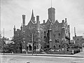
The Toledo and Ohio Central Railroad Station, today named Station 67, is a union meeting space and event hall located in Franklinton, near Downtown Columbus, Ohio. Built by the Toledo and Ohio Central Railroad from 1895 to 1896, it served as a passenger station until 1930. It served as an office and shelter for Volunteers of America from 1931 to 2003, and has been the headquarters of International Association of Fire Fighters Local 67, a firefighters' union, since 2007. The building was placed on the National Register of Historic Places in 1973. During its history, the building has experienced fires (in 1910 and 1975) and floods (in 1913 and 1957), though its relatively few owners have each made repairs and renovations to preserve the building's integrity. The building is the last remaining train station in Columbus.
The two-story structure was designed by prolific Columbus firm Yost & Packard in an eclectic style, with elements of Richardsonian Romanesque architecture and Japanese influences. It is made of variegated brick and sandstone with red tile roofs. Its central feature is a 3.5-story tower which once held clocks on three sides. The interior has seen modifications, though its main hall (the former passenger waiting room) still retains most of its original features.
The building's eclectic architecture has earned its appreciation as "one of the city's most whimsical and unusual buildings", and architect and Yale architecture school chair Paul Rudolph's favorite structure in the city. (Full article...) -

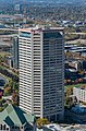
Huntington Center in downtown Columbus
Columbus, Ohio has a generally strong and diverse economy based on education, insurance, banking, fashion, defense, aviation, food, logistics, steel, energy, medical research, health care, hospitality, retail, and technology.
Prominent employers in the Columbus area include numerous schools (e.g., The Ohio State University) and hospitals, hi-tech research and development and information/library companies such as Battelle Memorial Institute, OCLC, and Chemical Abstracts, and retail clothing and restaurant companies (such as Limited Brands and Wendy`s). Other large employers include Alliance Data, Nationwide Insurance, JP Morgan Chase, American Electric Power, Huntington Bancshares, Worthington Industries and Cardinal Health, not to mention both state and local government. (Full article...) -
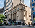
The Columbus Landmarks Foundation, known as Columbus Landmarks, is a nonprofit historic preservation organization in Columbus, Ohio. The foundation is best-known for its list of endangered sites in the city and its annual design award, given to buildings, landscapes, and other sites created or renovated in Columbus. It was established in 1977 as a project of the Junior League of Columbus, Ohio, following the demolition of the city's historic Union Station. It is headquartered at 57 Jefferson Avenue, a contributing structure in the Jefferson Avenue Historic District in Downtown Columbus. (Full article...) -
The Central Ohio Transit Authority (COTA) operates 41 fixed-route bus services throughout the Columbus metropolitan area in Central Ohio. The agency operates its standard and frequent bus services seven days per week, and rush hour service Monday to Friday. All buses and routes are wheelchair and mobility device-accessible, and include front-mounted bike racks.
The authority also operates multiple transit services, including the microtransit service COTA//PLUS and the on-demand COTA Mainstream service. (Full article...) -
Riverlea is a village in Franklin County, Ohio, United States, surrounded by Worthington on its north, south, and east sides, and bordered on the west by the Olentangy River, across which is Columbus. Riverlea was incorporated in 1939, a small community that formed on former farmland. The population was 599 at the 2020 census.
In 2011, Riverlea and Worthington explored the possibility of the annexation of Riverlea to Worthington. Riverlea voters defeated the annexation. (Full article...)


.jpg)


Need help?
Do you have a question about Columbus, Ohio that you can't find the answer to?
Consider asking it at the Wikipedia reference desk.
Selected images
-

-
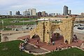
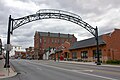 Old North Columbus Arch (from Neighborhoods in Columbus, Ohio)
 -
 The Santa Maria Ship & Museum, a Santa María replica, was docked downtown from 1991 to 2014. (from Columbus, Ohio)
 -
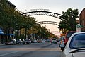 The iconic arches of the Short North (from Neighborhoods in Columbus, Ohio)
 -
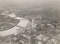 Columbus in 1936 (from History of Columbus, Ohio)
 -
 Italian Village rowhouse (from Neighborhoods in Columbus, Ohio)
 -
 Home in Old Oaks (from Neighborhoods in Columbus, Ohio)
 -
 Barlouie (from Neighborhoods in Columbus, Ohio)
 -
-
 Locations of numbered streets and avenues (from Columbus, Ohio)
 -
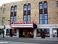 The historic Lincoln Theatre (from Neighborhoods in Columbus, Ohio)
 -
 Port Columbus Airport tower and terminal from 1929 to 1958 (from Columbus, Ohio)
 -
-

-
 The Art Deco LeVeque Tower is the city's second-tallest skyscraper. (from Columbus, Ohio)
 -
 Aerial view of Reeb-Hosack (from Neighborhoods in Columbus, Ohio)
 -
 Map of the Ohio Country between 1775 and 1794, depicting locations of battles and massacres surrounding the area that would eventually become the U.S. state of Ohio (from Columbus, Ohio)
 -
-
 Brewery District Scene (from Neighborhoods in Columbus, Ohio)
 -
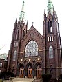
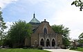 St. Mary Magdalene Church in Westgate (from Neighborhoods in Columbus, Ohio)
 -
 View of the city from Capital University in 1854 (from History of Columbus, Ohio)
 -
 Bird's eye view map of Columbus in 1872 (from Columbus, Ohio)
 -

-
 The city c. 1924 (from History of Columbus, Ohio)
 -
 John Glenn Columbus International Airport departure level (from Columbus, Ohio)
 -
 The Ohio State Fair is held in late July to early August. (from Columbus, Ohio)
 -
 Map of land surveys and city boundary growth, 1812–1920 (from History of Columbus, Ohio)
 -
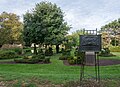
 Shrum Mound in Campbell Memorial Park (from Columbus, Ohio)
 -
 Municipal offices, including the Columbus Division of Police Headquarters, in the city's Civic Center (from Columbus, Ohio)
 -
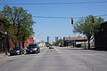 West Broad Street in Franklinton (from Neighborhoods in Columbus, Ohio)
 -
 The Columbus Museum of Art collects and exhibits American and European modern and contemporary art, folk art, glass art, and photography. (from Columbus, Ohio)
 -
 The Merion Village arch (from Neighborhoods in Columbus, Ohio)
 -
-
 Big Run Sports Complex, in Big Run Park (from Neighborhoods in Columbus, Ohio)
 -

-
The city in 1936 (from Columbus, Ohio)
-

-
 Hungarian Reform Church, in Hungarian Village (from Neighborhoods in Columbus, Ohio)
 -
 Aerial satellite image of Columbus (from Columbus, Ohio)
 -
 Dutch Colonial Style residences in Hungarian Village (from Neighborhoods in Columbus, Ohio)
 -
 Hilltop signage (from Neighborhoods in Columbus, Ohio)
 -
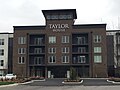 Taylor House on Bethel Rd. (from Neighborhoods in Columbus, Ohio)
 -
 Central Market stood on Fourth Street from 1850 to 1966 (from History of Columbus, Ohio)
 -
 Skyline of Columbus (Use cursor to identify buildings) (from List of tallest buildings in Columbus, Ohio)
 -
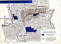 1954 urban renewal map of Columbus (from List of demolished buildings and structures in Columbus, Ohio)
 -

-
-
-

-
 Ohio Stadium, on the campus of Ohio State University, is the 5th-largest non-racing stadium in the world. (from Columbus, Ohio)
 -
-
Map of the Ohio Country between 1775 and 1794, depicting locations of battles and massacres surrounding the area that would eventually become Ohio (from History of Columbus, Ohio)
-
 2010 Census-based map: red dots indicate white Americans, blue dots for African Americans, green for Asian Americans, orange for Hispanic Americans, yellow for other races. Each dot represents 25 residents. (from Neighborhoods in Columbus, Ohio)
 -
 Street arches returned to the Short North in late 2002. (from History of Columbus, Ohio)
 -
 Victorian-style homes located along Goodale Park (from Neighborhoods in Columbus, Ohio)
 -

-
 Lou Berliner Sports Park (from List of parks in Columbus, Ohio)
 -
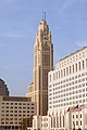 The LeVeque Tower was the tallest building in Columbus from 1927 to 1973. (from List of tallest buildings in Columbus, Ohio)
 -
 Camp Chase as it stands today, a memorial to fallen soldiers from the American Civil War. (from Neighborhoods in Columbus, Ohio)
 -
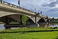 The Discovery Bridge (from Columbus, Ohio)
 -
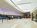
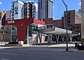 COTA's Spring Street Terminal, one of its five transit centers (from Columbus, Ohio)
 -
-
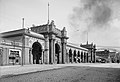
 Arcade of the third Union Station, the city's rail station from 1897 to 1977 (from Columbus, Ohio)
 -
 COSI (east entrance pictured) features themed, interactive science exhibits. (from Columbus, Ohio)
 -

-
View of the city from Capital University in 1854 (from Columbus, Ohio)
-
 The Pontifical College Josephinum (1888-1931) (from List of demolished buildings and structures in Columbus, Ohio)
 -
 Eastern side of Olentangy Commons (from Neighborhoods in Columbus, Ohio)
 -
Bird's eye view map of Columbus in 1872 (from History of Columbus, Ohio)
-
-
 Indianola Junior High School was the first middle school in the U.S. (from Columbus, Ohio)
 -
 Panorama of downtown Columbus from the Main Street Bridge (from Columbus, Ohio)
 -
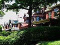
 Homes in German Village (from Neighborhoods in Columbus, Ohio)
 -
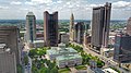 Four of the city's five tallest buildings are around Capitol Square (from List of tallest buildings in Columbus, Ohio)
 -
 Victorian houses facing Goodale Park in Victorian Village (from Columbus, Ohio)
 -
Shrum Mound, the feature of Campbell Memorial Park (from History of Columbus, Ohio)
-
 Holy Rosary and Saint John Church (from Neighborhoods in Columbus, Ohio)
 -

-
-
-
Racial distribution in Columbus in 2010: ⬤ White ⬤ Black ⬤ Asian ⬤ Hispanic ⬤ Other (from Columbus, Ohio)
-

-
-
 North Market (from Columbus, Ohio)
 -
 Historic Home in Harrison West (from Neighborhoods in Columbus, Ohio)
 -
Central Market, pictured here in 1898, operated from 1814 to 1966. (from Columbus, Ohio)
-
 Audubon nature center at Scioto Audubon Metro Park, the first built close to a major city's downtown (from Columbus, Ohio)
 -
 Columbus City Hall (from Columbus, Ohio)
 -
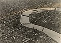
Downtown Columbus and the Scioto River c. 1924 (from Columbus, Ohio)


.jpg)


.jpg)


_-_exterior_2.jpg)


.jpg)


.png)


_crop.jpg)

.jpg)


Subcategories

- Select [►] to view subcategories
Subtopics
| Topics |  | ||||||
|---|---|---|---|---|---|---|---|
| Neighborhoods | |||||||
| Enclaves | |||||||
| History |
| ||||||
| Attractions | |||||||
| Government |
| ||||||
| Education |
| ||||||
| Transportation |
| ||||||
| Sports |
| ||||||
| Museums |
| ||||||
| |||||||
Associated Wikimedia
The following Wikimedia Foundation sister projects provide more on this subject:
-
 Commons
Free media repository -
 Wikibooks
Free textbooks and manuals -
 Wikidata
Free knowledge base -
 Wikinews
Free-content news -
 Wikiquote
Collection of quotations -
 Wikisource
Free-content library -
 Wikiversity
Free learning tools -
 Wiktionary
Dictionary and thesaurus
Category:United States portals by city Category:Portals needing placement of incoming links