
File:Bulgaria Provinces Map Blank.png
No higher resolution available.
Bulgaria_Provinces_Map_Blank.png (544 × 357 pixels, file size: 15 KB, MIME type: image/png)
| This is a file from the Wikimedia Commons. Information from its description page there is shown below. Commons is a freely licensed media file repository. You can help. |
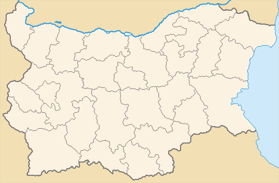
Summary
- English: Blank Map of the Provinces of Bulgaria.
- Bulgarian: области, oblasti - singular: област, oblast.
- Formerly termed the Districts or okrugs (pre-1999) of Bulgaria.
- See also wikipedia (english text): Provinces of Bulgaria.
- Mapa de Bulgària en blanc.
- Credits
Kroum removed names for use as a Template, image originally made by Lybomir Taushanov, improved by Todor Bozhinov and released under GFDL.
Licensing
| This file is licensed under the Creative Commons Attribution-Share Alike 3.0 Unported license. Subject to disclaimers. | ||
| ||
| This licensing tag was added to this file as part of the GFDL licensing update. |

|
Permission is granted to copy, distribute and/or modify this document under the terms of the GNU Free Documentation License, Version 1.2 or any later version published by the Free Software Foundation; with no Invariant Sections, no Front-Cover Texts, and no Back-Cover Texts. A copy of the license is included in the section entitled GNU Free Documentation License. Subject to disclaimers. |
History
- (Delete all revisions of this file) (cur) 05:44, 19 November 2006 . . Kroum (Talk | contribs | block) . . 548×361 (20,337 bytes) (A map of the administrative regions (области, oblasti) of Bulgaria. Kroum removed names for use as a Template, image originally made by Lybomir Taushanov, improved by Todor Bozhinov and released under)
- (del) (rev) 05:42, 19 November 2006 . . Kroum (Talk | contribs | block) . . 548×361 (20,902 bytes) (A map of the administrative regions (области, oblasti) of Bulgaria. Kroum removed names for use as a Template:, image originally made by Lybomir Taushanov, improved by Todor Bozhinov and released under GFDL.)
- (del) (rev) 03:21, 19 November 2006 . . Kroum (Talk | contribs | block) . . 548×361 (20,902 bytes) (A map of the administrative regions (области, oblasti) of Bulgaria. Kroum Removed names for use as a Template, image originally made by Lybomir Taushanov, improved by Todor Bozhinov and released under GFDL.)
| Annotations | This image is annotated: View the annotations at Commons |
File history
Click on a date/time to view the file as it appeared at that time.
| Date/Time | Thumbnail | Dimensions | User | Comment | |
|---|---|---|---|---|---|
| current | 02:46, 30 January 2012 | | 544 × 357 (15 KB) | Ras67 | cropped |
| 17:47, 2 May 2011 |  | 548 × 361 (20 KB) | Pensionero | Sofia - white | |
| 10:37, 3 January 2007 |  | 548 × 361 (20 KB) | Walden69 | Mapa de Bulgària en blanc {{PD-user|Kroum}} en:Image:Bulgaria_Provinces_Map_Blank.png Category:Maps of Bulgaria |
File usage
The following pages on the English Wikipedia use this file (pages on other projects are not listed):
Global file usage
The following other wikis use this file:
- Usage on de.wikipedia.org
- Usage on fi.wikipedia.org
- Usage on gl.wikipedia.org
- Usage on hu.wikipedia.org
- Usage on id.wikipedia.org
- Usage on it.wikipedia.org
- Usage on ja.wikipedia.org
- Usage on ka.wikipedia.org
- Usage on ko.wikipedia.org
- Usage on lt.wikipedia.org
- Usage on ms.wikipedia.org
- Usage on oc.wikipedia.org
- Usage on os.wikipedia.org
- Usage on pl.wikipedia.org
- Usage on pt.wikipedia.org
- Usage on ru.wikipedia.org
- Usage on sk.wikipedia.org
- Usage on sm.wikipedia.org
- Usage on sv.wikipedia.org
- Usage on www.wikidata.org
View more global usage of this file.