
File:AtHistEur1940.jpg
Size of this preview: 545 × 599 pixels. Other resolutions: 218 × 240 pixels | 436 × 480 pixels | 698 × 768 pixels | 931 × 1,024 pixels | 1,295 × 1,424 pixels.
Original file (1,295 × 1,424 pixels, file size: 229 KB, MIME type: image/jpeg)
| This is a file from the Wikimedia Commons. Information from its description page there is shown below. Commons is a freely licensed media file repository. You can help. |
File history
Click on a date/time to view the file as it appeared at that time.
| Date/Time | Thumbnail | Dimensions | User | Comment | |
|---|---|---|---|---|---|
| current | 14:51, 16 August 2018 | | 1,295 × 1,424 (229 KB) | Trecătorul răcit | Cleaned |
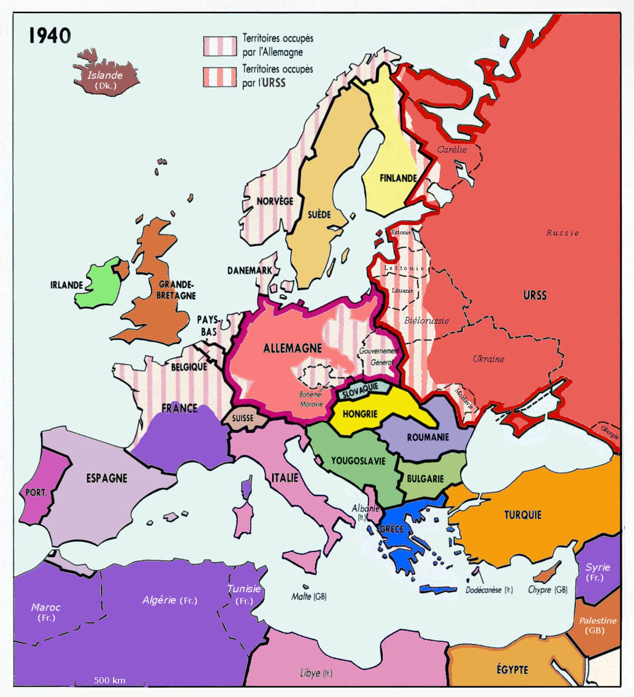
| 17:23, 8 March 2009 |  | 1,295 × 1,424 (232 KB) | Spiridon Ion Cepleanu | {{Information |Description={{en|1=Historical map of Europe, year 1940}} {{fr|1=Carte historique de l'Europe en 1940, d'après Anne Le Fur}} |Source=travail personnel (own work) |Author=Spiridon MANOLIU |Date=March 8, 2009 |Permis |
File usage
The following pages on the English Wikipedia use this file (pages on other projects are not listed):
Global file usage
The following other wikis use this file:
- Usage on fr.wikipedia.org
- Usage on gl.wikipedia.org
- Usage on pt.wikipedia.org
- Usage on uk.wikipedia.org